
Our Services
-
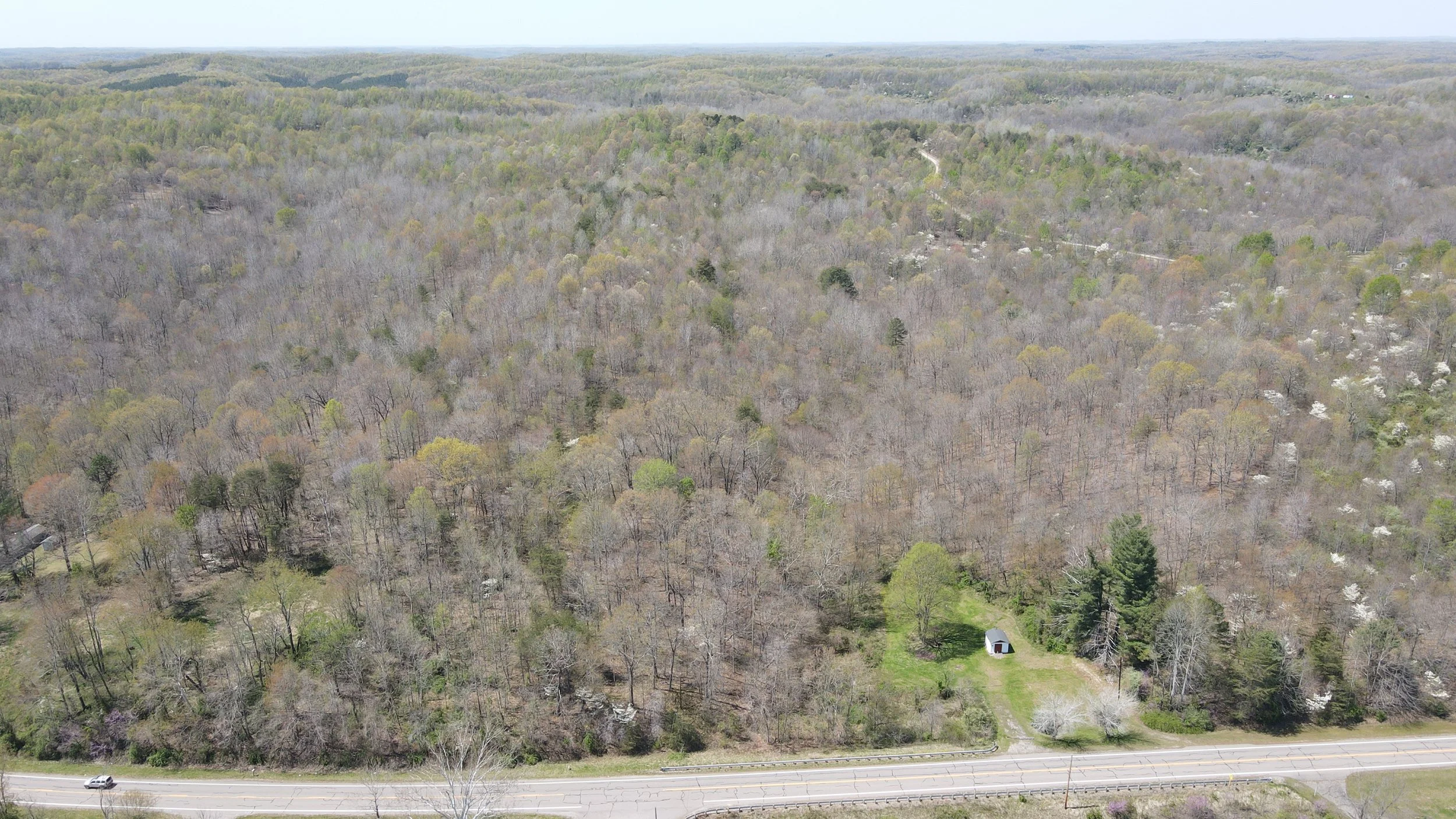
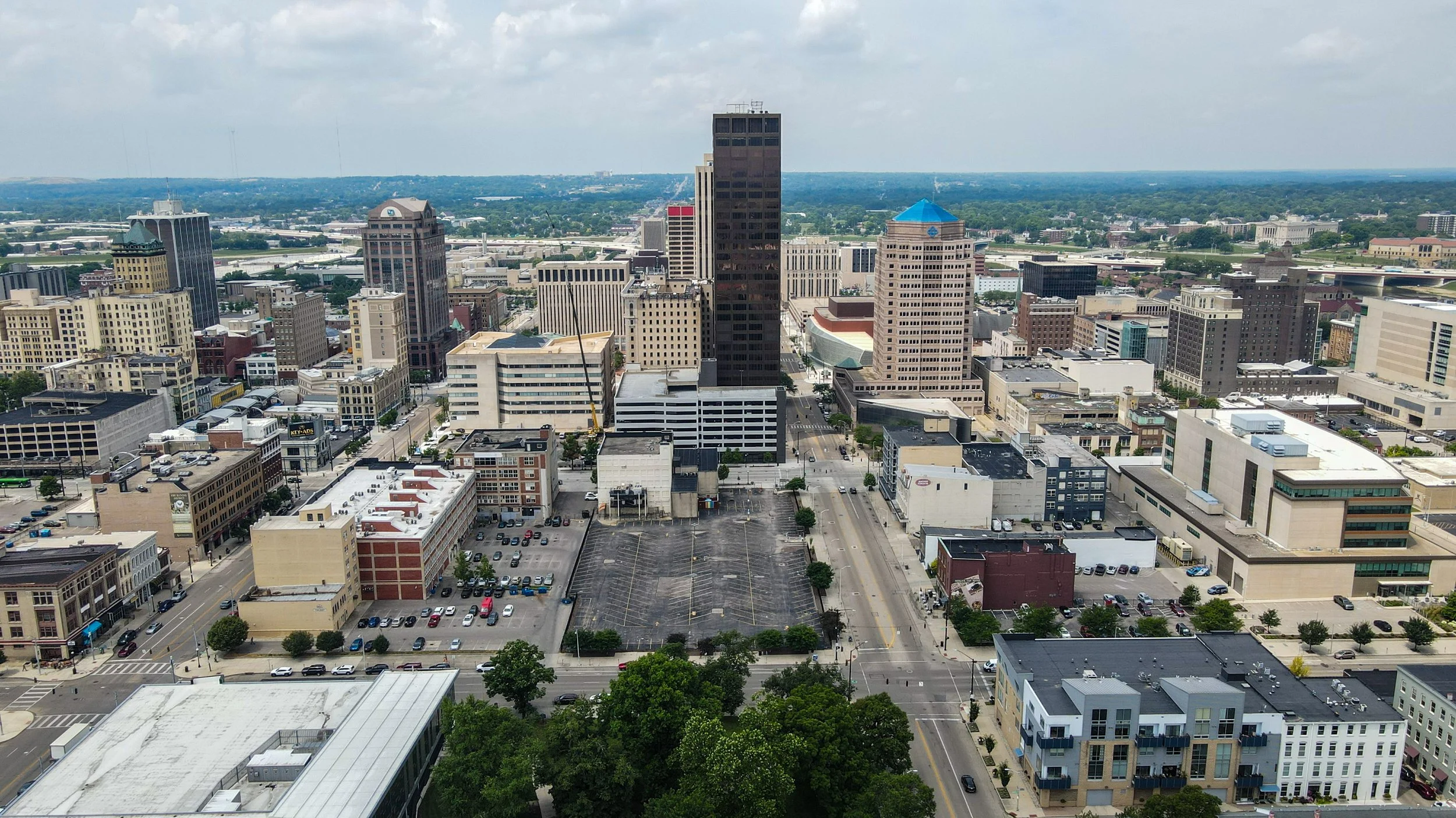
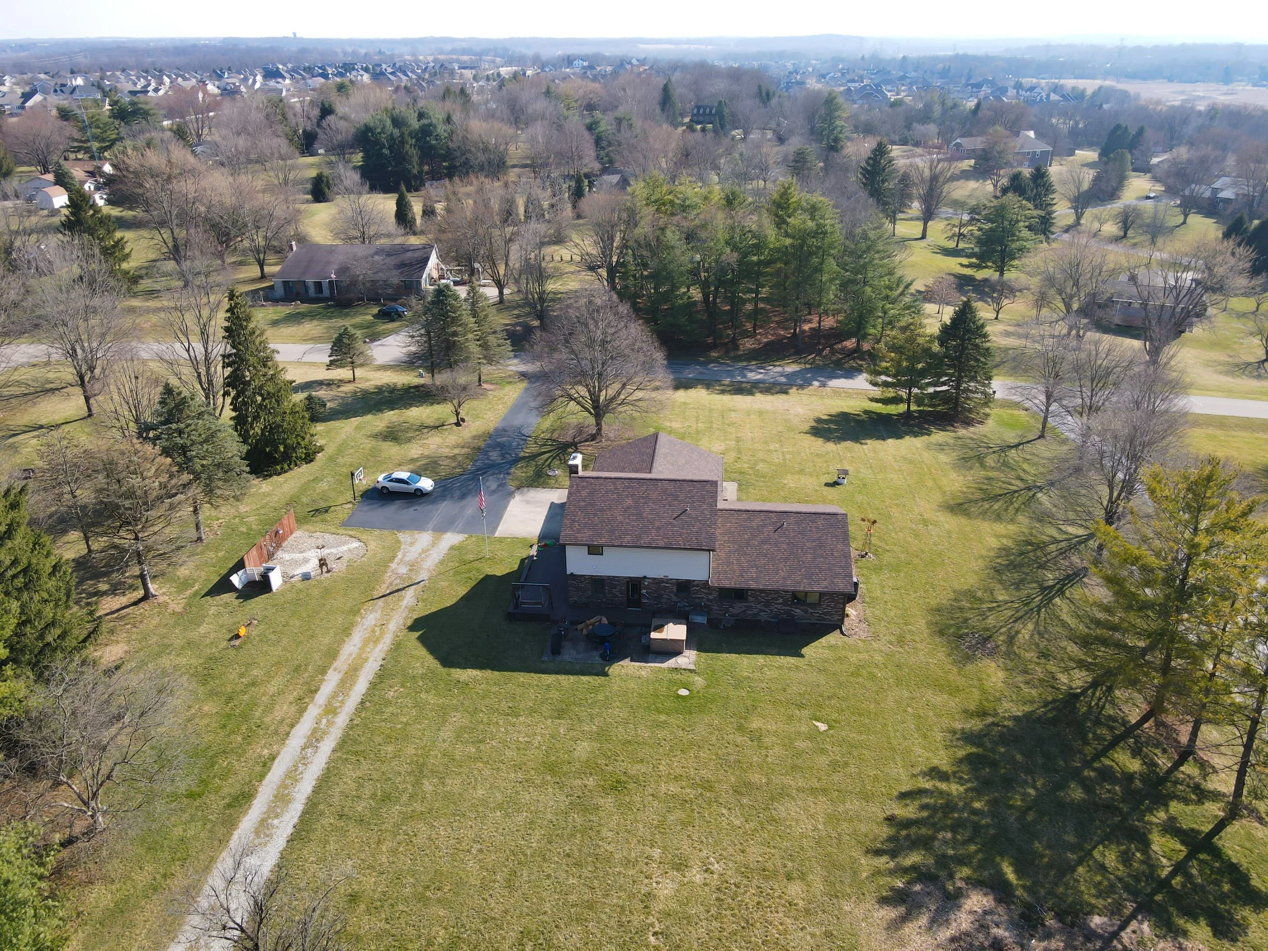
Capture attention. Close faster.
In today’s fast-paced real estate market, standing out is everything. Our cinematic aerial drone footage and immersive interior walkthroughs are designed to give potential buyers a true sense of a property before they ever step inside. Whether it’s highlighting a home’s curb appeal, showcasing unique architectural features, or capturing the surrounding neighborhood, we help listings shine online and in print.
We work with:
Real estate agents & brokers looking to elevate their listings on MLS and social media.
Builders & developers who want to showcase new construction projects.
Property managers & landlords who need professional visuals for rental listings.
Our real estate media services include:
High-resolution aerial photography to capture properties from every angle.
4K cinematic walkthrough videos for an engaging, professional presentation.
360 virtual tours that allow buyers to explore properties remotely.
Branded marketing materials ready for social media and MLS platforms
Twilight and golden-hour shots for maximum visual impact.
By combining stunning visuals with a marketing-focused approach, we not only help your listings attract attention, we help them sell faster, for more.
-
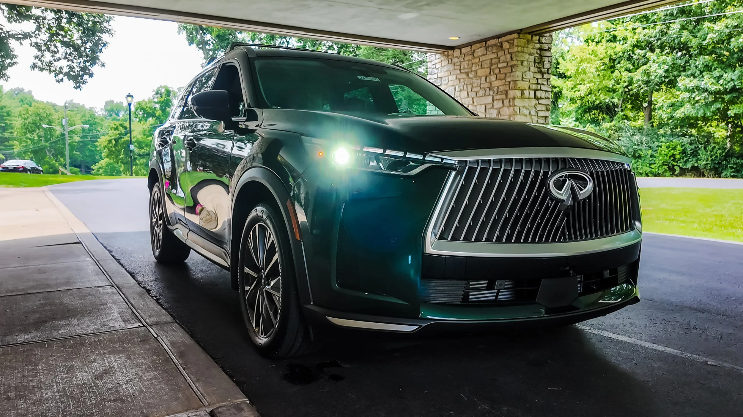
Drive traffic. Highlight inventory.
In the competitive automotive market, presentation is everything. Whether you’re looking to attract buyers to your lot, promote seasonal sales, or build your dealership’s online presence, our automotive media services are designed to make your inventory stand out.
We specialize in dynamic, high-impact visuals that connect with car enthusiasts and everyday buyers alike. From the moment a customer sees your vehicles online to the second they walk onto the lot, our media helps create a seamless, engaging experience.
We work with:
Dealerships & dealer groups aiming to boost online leads and showroom visits
Auto brands & marketing teams launching new models or campaigns
Car clubs & events looking to capture gatherings in cinematic style
Our automotive visual services include:
Aerial lot overviews showcasing your full inventory and dealership layout
High-resolution vehicle photography for websites, social media, and print ads
Cinematic promotional reels for campaigns, special events, and seasonal offers
Walkaround & feature videos highlighting each vehicle’s unique selling points
Coverage of automotive events such as cruise-ins, launches, and track days
With a blend of precision drone work and on-the-ground filming, we produce content that not only draws attention but also drives real results: more clicks, more calls, and more cars sold.
-
Precision footage. Safer inspections.
In the telecommunications industry, safety, accuracy, and speed are critical. Our drone and ground-based visual services provide telecom companies, contractors, and infrastructure managers with the data they need — without the risks and delays of traditional inspections.
By replacing manual climbs and time-consuming site visits with high-resolution aerial imagery and ground-level detail shots, we help you identify issues faster, plan maintenance more effectively, and keep your teams out of harm’s way.
We work with:
Telecom providers managing large tower networks
Construction & maintenance contractors needing pre- and post-work documentation
Infrastructure planners & engineers requiring accurate visuals for compliance and project planning
Our telecommunications services include:
Tower inspections for damage, corrosion, and equipment integrity
Line and cable surveys to spot wear, sagging, or hazards
Pre-construction site mapping to plan tower or antenna installations
Post-installation verification ensuring compliance and quality
Thermal imaging to detect overheating components or energy loss
Our goal is simple: deliver the clear, actionable data you need to maintain uptime, meet regulatory standards, and keep your crews safe. All while reducing inspection time and operational costs.
-
Smarter fields. Sharper yields.
In farming, every decision counts — and the right data can mean the difference between a good harvest and a great one. Our agricultural drone services give farmers and land managers the tools to see more, plan better, and operate smarter.
Using advanced aerial imaging, thermal sensors, and mapping software, we provide a detailed view of your crops, soil health, and livestock conditions — all without stepping foot in the field. This technology-driven approach saves time, reduces labor costs, and maximizes productivity.
We work with:
Crop farmers looking to monitor plant health and growth stages
Ranchers & livestock managers needing herd overviews and grazing assessments
Agricultural consultants advising on yield optimization and resource management
Our agriculture services include:
Aerial crop monitoring to detect stress, disease, and nutrient deficiencies early
NDVI and multispectral imaging for detailed plant health analysis
Field mapping for irrigation planning, planting accuracy, and land use optimization
Thermal imaging to assess water stress and optimize irrigation
Livestock overviews for quick head counts and grazing pattern analysis
Pre- and post-harvest documentation to evaluate yield and field conditions
By turning aerial data into actionable insights, we help farmers make informed, cost-effective decisions that improve yield quality, increase efficiency, and sustain the health of their land for years to come.
-
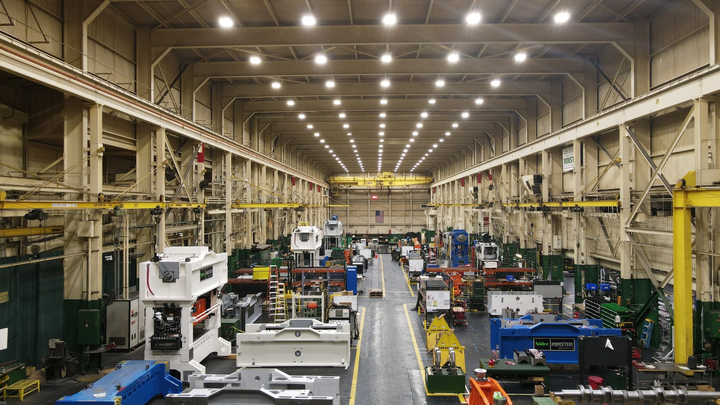
Stronger foundations. Smarter builds.
In construction and infrastructure development, precision and efficiency are key. Our drone and aerial imaging services give project managers, engineers, and developers the high-quality data they need to make confident, informed decisions — from the ground-breaking phase to final inspection.
By combining high-resolution aerial imagery, 3D mapping, and progress tracking, we help you monitor every stage of your project with unmatched accuracy. Whether you’re managing a single site or multiple developments, our visuals deliver the clarity needed to keep work on time, within budget, and compliant with safety regulations.
We work with:
Construction companies needing reliable project progress documentation
Developers & property managers tracking site readiness and improvements
Municipalities & infrastructure planners overseeing roads, bridges, and public works projects
Our construction & infrastructure services include:
Pre-construction site surveys to assess terrain and plan logistics
Aerial progress monitoring for weekly or monthly project updates
3D mapping & modeling for precise measurements and visual planning
Inspection services for hard-to-reach structures, reducing the need for costly scaffolding or lifts
Environmental impact assessments to ensure compliance with local and federal regulations
Marketing visuals to showcase completed projects to investors, stakeholders, or the public
With real-time data and powerful visual documentation, we help your team spot issues early, improve coordination, and keep projects moving forward efficiently — all while reducing operational risk.
-
Eyes in the sky when every second counts.
When disaster strikes, every moment and every decision matters. Our drone technology provides real-time aerial intelligence that helps emergency teams respond faster, safer, and more effectively. Whether it’s a natural disaster, large-scale accident, or active search and rescue mission, we deliver a bird’s-eye view that ground crews simply can’t get on their own.
By capturing high-resolution aerial visuals in real time, we equip command centers and field teams with the data they need for rapid situational awareness — from pinpointing hazards to assessing damage zones and directing resources where they’re needed most.
We work with:
Fire departments for wildfire monitoring, structure fire assessment, and hazardous area surveillance
Search & rescue teams to locate missing persons quickly and safely
Law enforcement for event crowd monitoring, accident reconstruction, and tactical operations
Disaster relief organizations for flood mapping, storm damage assessment, and infrastructure checks
Our emergency management & response services include:
Real-time live streaming to command centers for instant decision-making
Thermal imaging to detect heat signatures in low visibility conditions
Damage mapping & documentation for insurance and disaster recovery claims
Rapid deployment inspections for unstable buildings, hazardous sites, and inaccessible terrain
Environmental monitoring during and after severe weather events
With our advanced aerial capabilities, agencies can reduce risk to personnel, speed up critical operations, and gain the clarity needed to protect both lives and property.